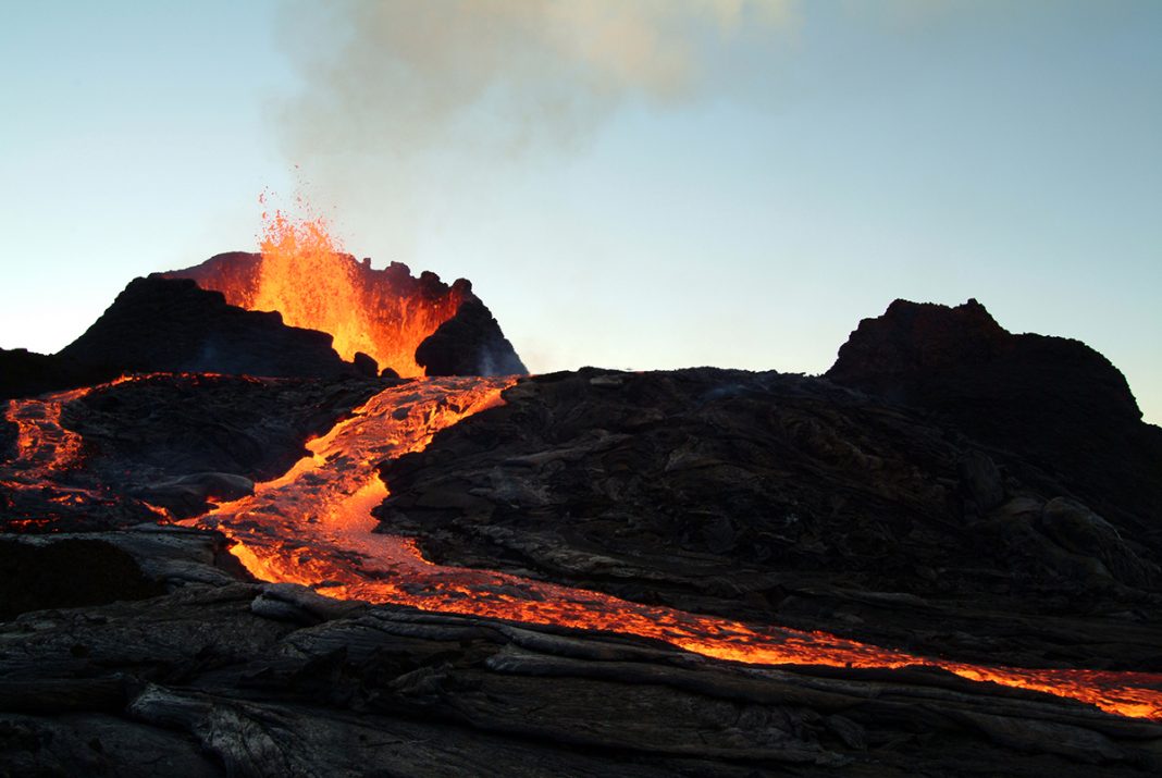
Craig Magee, NERC Independent Research Fellow at the University of Leeds illustrates the important role of structural geology in improving volcano forecasting
Over 800 million people live near volcanoes. To keep people safe and secure, we need to be able to reliably forecast when, where, and how volcanoes might erupt. Importantly, before many eruptions occur, we see tell-tale signals warning of imminent activity. These warning signals can include subtle elevation changes in local topography or an increase in earthquakes. Yet forecasting eruptions is extremely difficult because every volcano is unique: warning signals at one volcano may differ to those at another, and even warning signals that herald different eruptions at the same volcano can vary. By improving our knowledge of volcanoes, through the support of organisations like NERC, we can constrain the probabilities of when, where, and how volcanoes might erupt.
Under pressure
As batches of molten rock (magma) inject up through the crust, they often get stuck. Here, the magma begins to cool and crystallise, slowly forming into a ‘mush’ that contains crystals, some fluid magma, and bubbles of released gas. By increasing the volume of magma and gases in the system, its pressure can build and may eventually drive an eruption. This pressurisation is controlled by the magma properties (chemistry and physics) and the composition and structure of the surrounding (host) rock. The uniqueness of volcanoes arises because all magmas are different and there is a near-infinite combination of host rock composition and structure beneath volcanoes. These differences in the magma and host rock affect when, where, and how volcanoes might erupt, and also dictate the style of any eruption warning signals.
The role of structural geology
Structural geologists study how rocks deform through space and time, and how they are reshaped and rearranged by these processes. When magma starts to inject and accumulate beneath volcanoes, it creates space for itself by pushing away (deforming) the surrounding rock. Even though the magma may be located at depths of several kilometres or more, the force it exerts on the overlying rocks can be enough to break them and/or push them and the ground surface upwards. We monitor volcanoes by using:
- Satellites or ground-based tools to measure millimetre-scale changes in surface elevation.
- Seismometers to find earthquakes generated as magma breaks (fractures) the host rock.
These techniques can tell us if a volcano is active, but not if an eruption will happen. However, by measuring the products of magma-driven host rock deformation, we can start to estimate where magma is located and how much there may be. This information on what is going on beneath a volcano is critical to eruption forecasting.
Dykes and dyke-induced faults
Monitoring deformation signals is one aspect to improving eruption forecasting, but we also need to understand the relationship between magma injection, accumulation, and deformation to properly interpret signals. This is where my NERC-funded research as a structural geologist comes in. I currently study dykes, which are the main pathways for magma to move through the crust. Dykes are vertical sheets of magma that are usually several metres to tens of metres wide, several kilometres high, and tens to hundreds of kilometres long. To make space for itself, a dyke will push away the rock to either side, causing extension. Before many dykes reach the surface, their injection drives extension of overlying intact rock. This extension can pull apart and crack the overlying rock, creating two fractures (faults) that can be seen at the surface and are inclined towards and meet at the top of the dyke, forming a ‘V-shaped’ pattern. At the surface, these faults appear as two parallel cracks with the ground and rock in-between them having slipped down and subsided. We call these cracks ‘dyke-induced faults’, because they were generated by dyke injection at depth, and can see them in volcanic areas on Earth (Hawaii, Iceland, Ethiopia, etc.) and other planets (Mars). The formation of dyke-induced faults can occur before and during eruptions.
What can dyke-induced faults tell us about volcanic systems?
We often measure the distance between a pair of dyke-induced faults and the extension across them at the surface, to estimate the depth and thickness of the underlying dyke. These estimates are useful because they could help tell us how close magma is to the surface and how much magma there is. However, although we can see dyke-induced faults at the surface, and we can recreate them in sandbox or computer models, we do not actually know how they connect and relate to natural dykes. So how do we know our estimates are correct?
I found a series of dykes and dyke-induced faults, buried beneath sediments offshore north-west Australia, that are imaged in seismic reflection data. (1) The seismic reflection technique can produce ultrasound-like images of Earth’s subsurface in 3D. With this data, I have been able to measure the ancient surface expression of the dyke-induced faults and from these, estimate underlying dyke properties. Yet unlike other studies, I can also directly measure the underlying dykes. This allows me to compare the fit between estimates of dyke properties and the actual dyke properties. From my results, it seems that how we typically estimate dyke properties from the surface expression of dyke-induced faults is not always accurate. (2) This is because the composition and structure of the host rock is variable and affects how faults grow, such that they do not have a true ‘V-shape.’ Future research will explore how we can modify our methodologies to improve the accuracy and reliability of dyke properties estimated from dyke-induced fault surface expressions.
References
(1) Magee, C. and Jackson, C.A.L., 2020. Seismic reflection data reveal the 3D structure of the newly discovered Exmouth Dyke Swarm, offshore NW Australia. Solid Earth, 11(2), pp.579-606.
(2) Magee, C. and Jackson, C.A.L., 2021. Can we relate the surface expression of dike-induced normal faults to subsurface dike geometry?. Geology, 49(4), pp.366-371.


