Melissa Ward Jones, a Research Assistant Professor at the Water and Environmental Research Center (WERC) of the University of Alaska Fairbanks, discusses research focused on understanding the interactions of permafrost thaw and agriculture
While there are many different responses of permafrost thaw (Ward Jones, 2024), one of the most impressive consequences is thaw subsidence (lowering or collapse of the land surface) when permafrost is ice-rich. Farmers-collaborators participating in the Permafrost Grown Project, a $3 million, five-year (2022- 2027) transdisciplinary project based at the University of Alaska Fairbanks and funded by the US National Science Foundation, have described various ways thaw subsidence impacts their agricultural fields and practices. This includes changing surface topography, changing surface water flow patterns, killing crops, and abandoning whole or parts of fields.
Measuring thaw subsidence
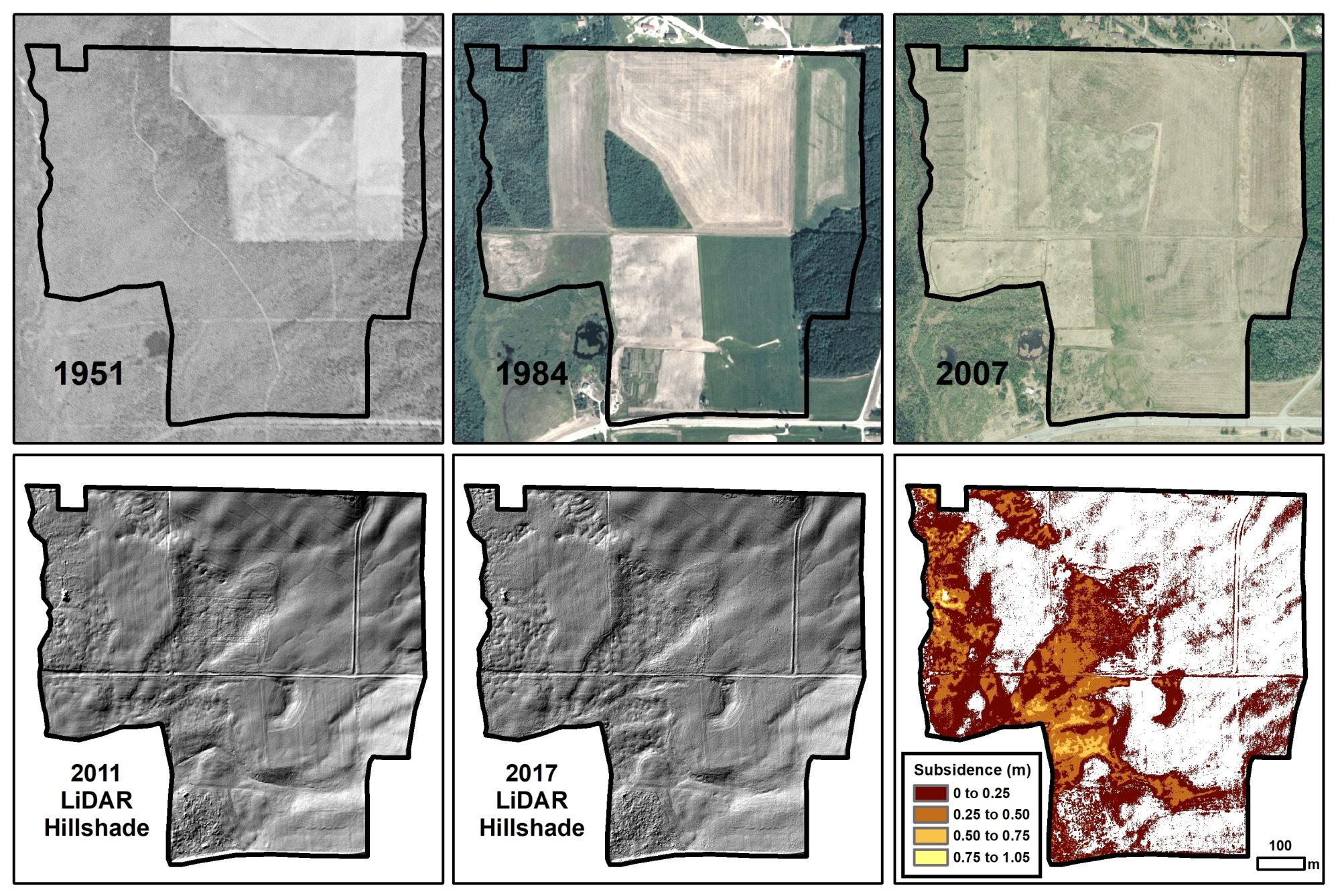
While anecdotal observations of ground surface lowering are helpful, the only way to formally measure thaw subsidence amounts is by comparing land surface elevations of 3D digital surface models (DSMs). These models can be produced by various techniques, including stitching together images taken at different angles in a technique called stereo pair photogrammetry or a technique called light detection and ranging (LiDAR), which sends out light particles and maps elevation when light particles return to the sensor. Both have tradeoffs and limitations: while stereo pair photogrammetry is less expensive, vegetation is included in the DSM, limiting certain analyses in specific areas, like those that are forested, whereas LiDAR, which is much more costly, can remove surface vegetation so that the resulting DSM only represents the ground surface. Both mapping techniques can be collected by aircraft or unmanned aerial vehicles (UAVs). Pairing DSMs collected repeatedly in the same area over different time periods with satellite imagery provides methods for tracking and measuring permafrost thaw.
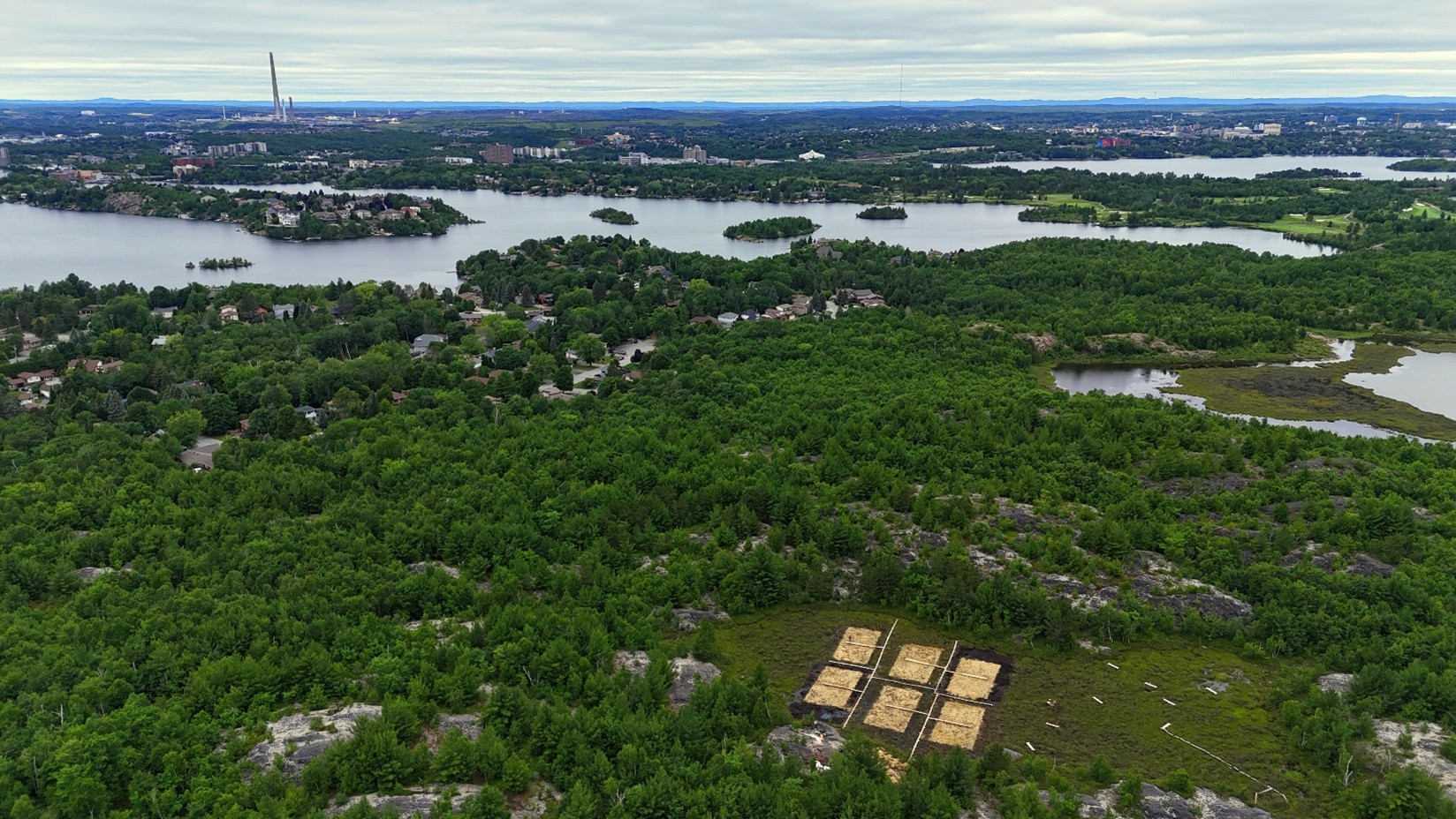
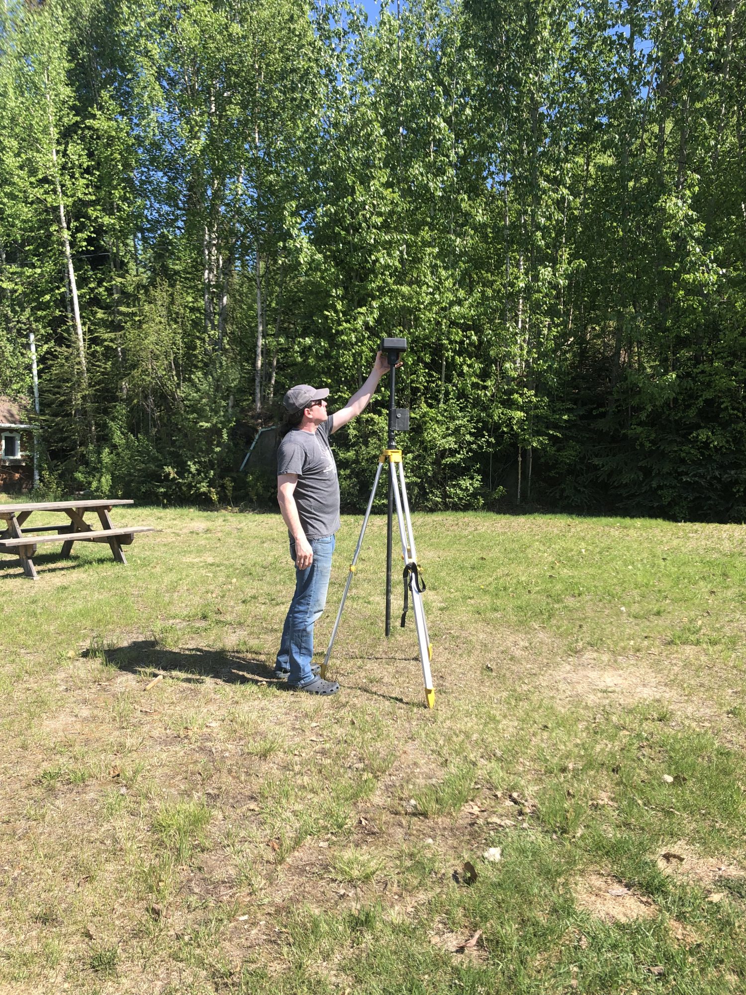
This work monitoring permafrost thaw using remote sensing, led by co-PI Benjamin Jones (Figure 1), has used a combination of data collected by the Alaska Division of Geological and Geophysical Surveys (DGGS Staff, 2013) using airborne sensors, UAVs utilizing both stereo pair photogrammetry and LiDAR (header image) while also incorporating time series from satellite images (Figure 2). This work both supports and is supported by other project efforts, including ground drilling to measure permafrost conditions such as ground ice content and depth to the top of the permafrost table, as well as dating the onset of thaw subsidence from tree cores collected from leaning trees (known as dendrogeomorphology).
Ongoing research
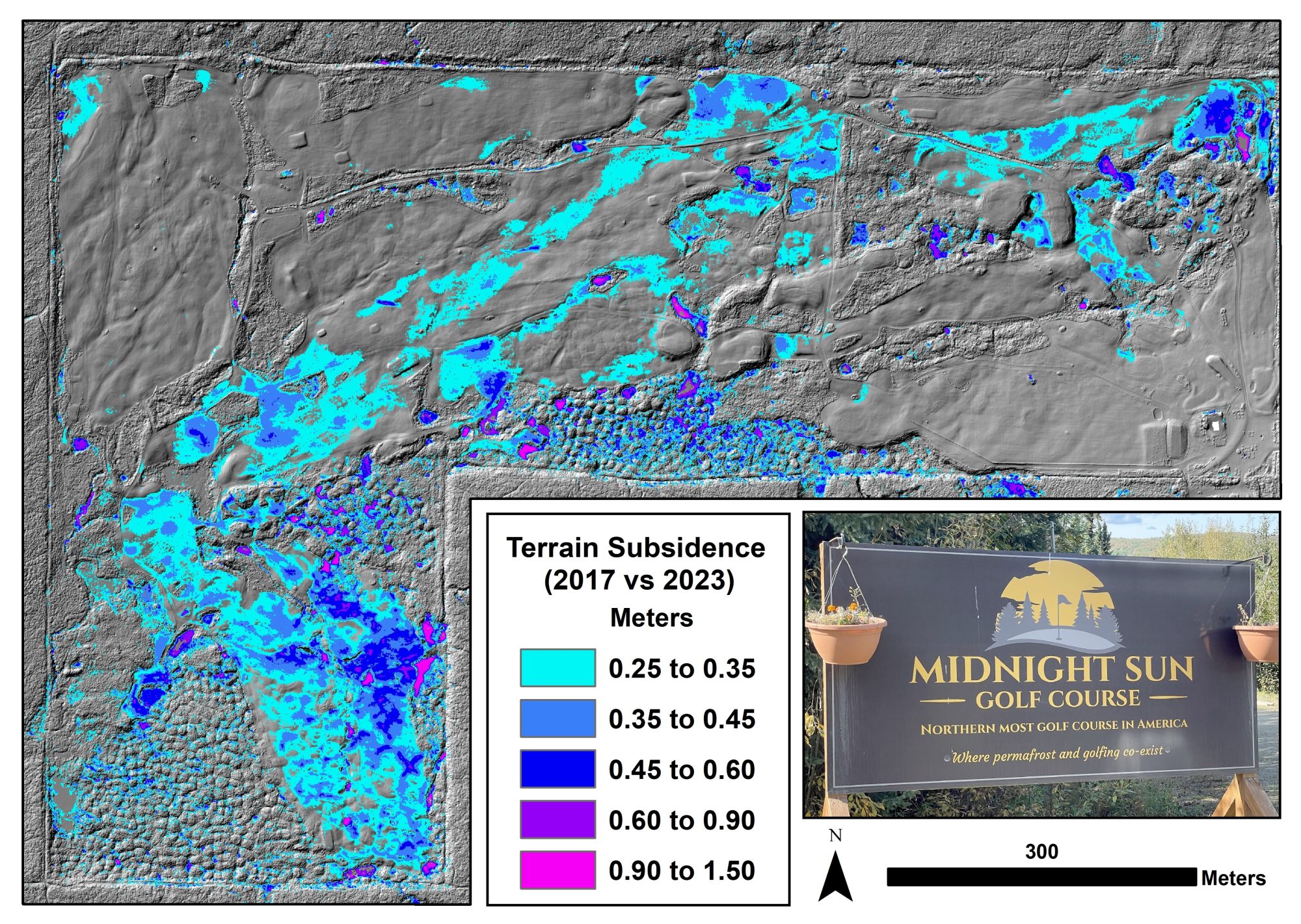
While this work is ongoing, preliminary data analysis suggests that thaw subsidence activity varies in timing and the amount of ground surface collapse. It appears to be driven primarily by localized factors, but work is beginning to study if there is a connection between thaw subsidence activity and regional climate patterns. We are also monitoring thaw subsidence in abandoned fields and fields initially cleared for agriculture, which are now being used for different uses, such as a golf course (Figure 3). Overall, this work is an essential component in understanding permafrost-agriculture interactions and enables the quantification of both farm field and permafrost evolution (Figure 1).
Funding acknowledgement
Permafrost Grown is funded by the U.S. National Science Foundation RISE award 2126965.
References
- DGGS Staff. 2013. Elevation datasets of Alaska: Alaska division of geological & geophysical surveys digital data series 4, https://elevation.alaska.gov/
- Jones, B., and Ward Jones, M. (2023). Midnight Sun Golf Course Classified LiDAR Point Cloud, Digital Surface Model, Digital Terrain Model, Digital Photos, and Orthophoto Mosaic; Fairbanks, AK; 10 September 2023. Arctic Data Center. doi:10.18739/A2W37KX40.
- Ward Jones, M. (2024). Permafrost grown: The heterogeneity of permafrost conditions. Open Access Government April 2024, pp.386-387. doi: 10.56367/ OAG-042-11172
- Ward Jones, M., Habeck, O.H., Ulrich, M., Crate, S., Gannon, G., Schwoerer, T., Jones, B., Kanevskiy, M., Baral, P., Maharjan, A., Steiner, J., Spring, A., Price, M.J., Bysouth, D., Forbes, B.C., Verdonen, M., Kumpula, T., Strauss, J., Windirsch, T., Poeplau, C., Shur, Y., Gaglioti, B., Parlato, N., Tao, F., Turetsky, M., Grand, S., Unc, A., and Borchard, N. (2024). Socio-ecological dynamics of diverse global permafrost-agroecosystems under environmental change. Arctic, Antarctic, and Alpine Research, 56(1). doi: 10.1080/15230430.2024.2356067