The National Oceanic and Atmospheric Administration have a mission to understand and predict changes in weather, climate, oceans and coasts, as this article reveals
The National Oceanic and Atmospheric Administration (NOAA) are a U.S. agency that aims to enrich life through science. Their scope of work goes from the surface of the sun to the depths of the ocean floor, as they do what they do to ensure that the public is kept up to speed with the changing environment that surrounds them.
By way of background information, we know that President Thomas Jefferson founded the U.S. Coast and Geodetic Survey (as the Survey of the Coast) to provide nautical charts for the maritime community to ensure safe passage into American ports and along their extensive coastline, way back in 1807. (1)
Today, NOAA’s vital work includes severe storm warnings, daily weather forecasts and climate monitoring, as well as coastal restoration, fisheries management support for marine commerce.
Dedicated scientists at NOAA use high-tech instrumentation and cutting-edge research to give citizens, emergency managers, planners and other decision makers with reliable information they need when it is required. (2) Certainly, science underpins all NOAA does, for example, when it comes to weather forecasts and warnings, climate information, coastal management recommendations, fishing regulations and satellites in space. Many of NOAA’s scientists are respected as national and international experts in their fields and the quality of their work is considered to be exemplary. (3)
The mission of NOAA can be summed up as follows:
- To predict and understand changes in weather, climate, oceans and coasts;
- To share such knowledge and information with other people;
- To manage and conserve coastal and marine ecosystems and resources (4)
Coastal and marine ecosystems and resources
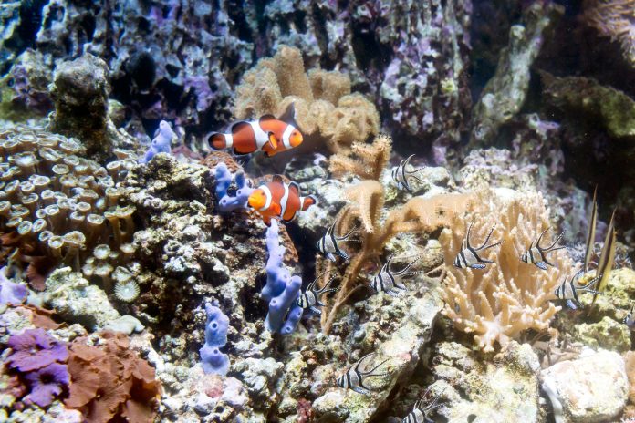
This article will focus on the third aspect of NOAA’s work mentioned above that concerns managing and conserving coastal and marine ecosystems and resources. We know that NOAA has direct authority to sustain and to regulate marine fisheries and their ecosystems, protect and restore habitats and ecosystems, protect endangered marine and anadromous species, conserve marine sanctuaries and other protected places, respond to environmental emergencies and aid in disaster recovery.
In April this year, a new web-based interactive tool for ocean mapping and planning was created to give everyone from ocean industries to coastal managers, students, plus the public the chance to be an ocean explorer from their own computer. The tool was made by the NOAA and the Department of the Interior’s Bureau of Ocean Energy Management.
The new OceanReports web tool, gives users specialised ‘ocean neighbourhood analyses’ including graphics and maps by analysing no less than 100 ocean datasets at the same time.
Did you know that U.S. ocean waters make up a total of almost four million square miles and is one of the largest Exclusive Economic Zones (EEZ) globally? Did you know that detailed information about habitats and species, industries in the area, potential hazards such as undersea cables or shipwrecks, the economic value of ocean commerce and other detailed oceanographic information can be at your fingertips using the Ocean- Reports tool?
“The world’s largest collection of ‘ocean intelligence’ can now be accessed to help sustain and grow one of the world’s largest blue economies,” says Neil Jacobs, Ph.D., Acting NOAA Administrator. “Whether it’s aquaculture siting, marine transportation, or offshore energy, OceanReports puts this data at our fingertips and gives us an edge as we continue to grow our national economy.”
In addition, while OceanReports offer an abundance of data for use by science and industry, it’s easy to use in the classroom to help students studying biology, chemistry, geography and even other disciplines like economics, according to the NOAA. This excellent work is certainly a fitting example of how the NOAA as a U.S. agency aims to enrich life through science, as this article draws to a close.
“With such a diverse range of ocean uses and stakeholders, the OceanReports tool greatly increases one’s ability to understand and manage the resources in the complex ocean environment,” comments BOEM Acting Director, Walter Cruickshank. “Our team worked diligently with NOAA to create this tool, which benefits the ocean community in addition to helping BOEM carry out its mission—the responsible development of ocean energy and marine mineral resources for the nation.” (6)
Did you know that the Sargasso Sea can be found entirely within the Atlantic Ocean and it is the only sea that does not have a land boundary? The Sargasso Sea is well-known for a genus of free-floating seaweed called Sargassum? It’s true to say that there are a number of different types of algae located in the world’s oceans but the Sea is unique because it harbours holopelagi, a species of Sargassum. By way of further explanation, holopelagi means that the algae reproduces vegetatively on the high seas, as well as freely floating around the ocean. Added to his, we know that other seaweeds reproduce and begin life on the floor of the ocean.
Sargassum hosts an amazing variety of marine species, for example, it is an essential habitat for crab, fish, shrimp and other marine species that have adapted to this environment. In addition, did you know that turtles use Sargassum mats as nurseries where hatchlings have food and shelter?
Threatened and endangered eels, as well as porbeagle shark and dolphinfish, as well as white marlin, have made the Sargasso Sea their place of habitation. Humpback and commercial fish, such as tuna and birds migrate through the Sargasso Sea and depend on it for their sustenance.
The Sargasso Sea is defined only by ocean currents which contrasts sharply with the other seas in the world which are to some extent, of course, characterised by land boundaries. The Gulf Stream establishes the Sargasso Sea’s western boundary, while the Sea is further defined to the north by the North Atlantic Current, to the south by the North Atlantic Equatorial Current and to the east, by the Canary Current. (5)
References
1 https://www.noaa.gov/our-history
2 https://www.noaa.gov/about-our-agency
3 https://www.noaa.gov/our-commitment-to-science
4 https://www.noaa.gov/our-mission-and-vision
5 https://oceanservice.noaa.gov/facts/sargassosea.html
6 https://www.noaa.gov/media-release/new-oceanreports-tool-brings-ocean-data-to-your-fingertips
Open Access Government





Is the grey seal population on the Cape and Islands having an impact on the coastal and marine ecosystem?