Gwo-shyh Song, Associate Professor at the National Taiwan University walks us through types of marine geohazards investigated in offshore wind farm construction
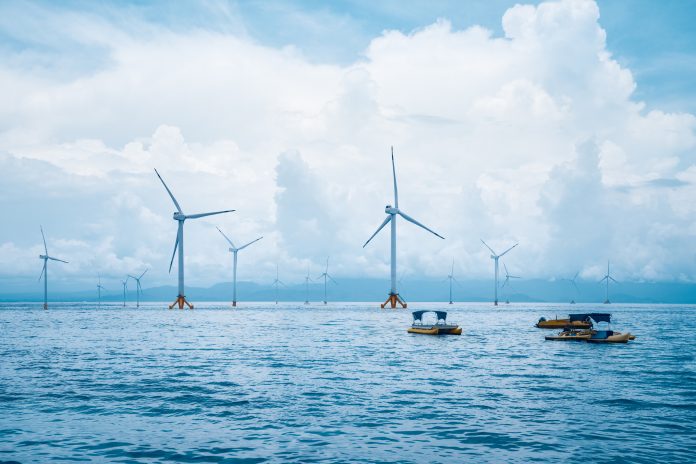
Taiwan is situated in the collision zone of the Philippine Sea Plate and Eurasian Plate, such that it is a product of orogeny with high mountains. Most of the offshore wind farms are located by the western coast of this Orogen, and near a so-call deformation front where the most active or youngest faults are located. Along these fault zones, every decade or so, a major earthquake of magnitude 6.0 or more occurs. Therefore, since offshore wind farm construction in Taiwan is mostly undertaken using base piles to penetrate the seabed 60 to 80 metres deep underground, it is necessary to conduct a complete marine geological or geophysical survey in the offshore wind farm area before construction to see if there are significant geohazards that might have occurred in the area.
For marine geohazards, according to their nature, the identified geohazards are grouped into the categories defined after the grouping of features, process, and related events with similar nature. Most of material are adapted from João M. R. Camargo et al. (2019): “Marine Geohazards: A Bibliometric-Based Review” Review article.
The importance of the oil and gas industry, as well as offshore wind farm, in boosting scientific survey that was related to marine geohazards is evident, primarily during the first phase, when most reports involved the study of seepage fluids, slope failure, faulting, and diapirs. To a lesser extent, they involved the investigation of bedforms, positive and negative reliefs. The occurrence of studies on earthquakes, tsunamis, volcanism, and erosion was rare. By the second and third phases, diversification was the rule, with an emphasis on investigations on slope failure, fluid seepage, tsunami, faulting, negative reliefs and earthquakes.
The categories are described below. Being in common, the interaction between more than one, that is, a category described here is the trigger of another one, in a causal relation.
Slope failure
Slope failures represent a major threat, not only to the marine industry, but also to the marine environment and coastal facilities. They can lead to substrata instability and produce catastrophic losses in geotechnical drilling and cable and wind turbine foundation construction. This geohazard is indicative of its widespread occurrence along continental margins and its socioeconomic impacts. It is subject to severe damage due to the occurrence of submarine landslides. The main factors that contribute to the initiation of submarine landslides include rapid sedimentation rates, gas and gas hydrates, groundwater seepage, tectonic activity, volcanic activity and human activity.
Fluid seepage
Seabed fluid flow is the second most investigated category of a geohazard. Generally, such processes include the leakage of water, light hydrocarbons and sediments. The use of acoustic techniques to detect gas emissions escaping through the seabed into the water column has increased as a major tool in recent decades. Evidence of this marine geohazard includes surface features, such as pockmarks, carbonate mounds, and mud volcanoes, and also subsurface features, such as gas chimney, gassy sediments and gas hydrate, and even by acoustic ‘plumes’, ‘flames’ and ‘clouds’ in the water column.
Pockmarks and mud volcanoes are the superficial expression of seabed fluid flow and are related to chimneys and geological faults which set a dangerous scenario, especially for drilling operations. Usually, shallow gas is a term used to characterise the gas buried in shallow sediments, together with shallow water flow that is driven by high pressure after drilling hits over-pressured sand layers.
Earthquakes
Earthquakes are geological events that were recognised even in ancient times, in all cultures, earthquakes are among the most damaging events caused by the Earth and pose a serious threat to lives and property in urban areas near major active faults on land or subduction zones offshore. This marine geohazard deserves its prominence because, depending on the magnitude and depth of an earthquake, it can trigger slope failures, tsunamis and gas seepage. In addition, earthquakes can generate local damage such as cable breaks and, in the case of tsunamis, impact distant regions on another margin of an ocean basin.
Volcanism
This category of marine geohazards is related to submarine eruptions and volcanic island flank collapse. Shallow seamounts and volcanic islands may eventually be subject to underwater eruptions as the volcanic edifice evolves. Explosive activity at seamounts is related to the eventual collapse of the flanks in the volcanic edifice. The cause of these collapses is due to the continuous accumulation of volcanic material that at some point renders the slope unstable.
Subsidence
This category of marine geohazards is related to two different geological processes. One of them is the characteristic subsidence of converging continental margins. Another process is the subsidence of coastal areas (such as the deltas) exposed to a high sedimentation rate. The impact of this geohazard is slow and gradual, generally with a reduced potential for material damage and loss of life.
Bedforms
This category of marine geohazards is related to environments exposed to hydrodynamic forcing, capable of generating mobile bedforms. Mobile bedforms are of critical engineering importance in the placement of submarine cables. The challenges include the potential exposure of buried foundations and excessive burial of thermally sensitive power cables.
Positive Reliefs
This category of geohazard is represented by positive topographic features such as reefs, outcrops, beach rocks, mounds and ridges. These features represent natural obstacles that should be avoided in engineering projects involving telecommunications cables, or any other infrastructure to be installed next to the seafloor.
Negative Reliefs
This group of marine geohazards is related to channels, canyons, gullies and steep slopes. Some topographic features pose risks to submarine cables, and the cable route should, as much as possible, avoid them. Negative reliefs, like submarine channels, are considered conduits for sediment transport; therefore, submarine canyons and channels are commonly associated with slope failures, sediment gravity flows and mobile bedforms.
Diapirs
Salt and mud diapirs are intrusions of sedimentary rocks into the overlying sedimentary sequence that usually imply deformations in the seafloor. The loading of the overlying sediment is responsible for the deformation of the salt flow and its direction toward the surface as fingers of salt (diapirs). Salt diapirs may generate outcrops (salt domes) on the surface of the seafloor, which, in turn, may interfere with the stability of engineering structures. Mud diapirs/volcanos are also related to this group and are commonly produced by the release of high-pressure fluids, which can seriously reduce sediment shear strength and cause shallow sediment deformations that affect seabed installations.
Faulting
This group of marine geohazards is related to tectonic events, which can trigger earthquakes and tsunamis. Active faults are susceptible to ground surface ruptures that can compromise wind turbine and submarine cables. Therefore, active failures have been mapped and investigated to determine the level of their activity (recurrence times, displacements, slip rates) in the context of seismic hazard assessments.
Please note: This is a commercial profile

