Gwo-shyh Song from Global Aqua Survey Ltd and National Taiwan University, highlights a special skill concerning the use of the side-scan sonar to scan underwater targets or side-slope structures in this marine survey focus
A side-scan sonar survey is applied world-wide and can be used in the ocean by hydrographers, marine geologists, marine engineers and has been extended to the field of environmental applications. One of these applications is the investigation of hydrological land use in lakes and reservoirs where lots of siltation has occurred or an abundance of deposits are carried into territories from upstream or by landslides from the slope. For the offshore wind farm industry, it can be used to inspect the turbine foundation standing on the seafloor to check its stabilisation and cable layout condition.
The side-scan sonar is routinely used. Sometimes it is used by relatively inexperienced personnel, making the scanned image quality too poor to interpret. This is because the key to success is in understanding the geometry of the acoustic wave propagation to the insonified targets. Producing substantial shadows in the record for objects that protrude above the bottom of the seafloor are critical.

Acoustic shadows
A good sonar record is one that shows great detail. Bottom echo returns from a strong reflector will be printed as dark lines or areas. An acoustic shadow behind a protruding object produces a light area on the record. This means that a good record is one with approximately even intensity over the entire data range. The recorder gain settings must be tuned to create proper acoustic shadows.

To create shadows, operators are always trying to tow the side-scan sonar transducer at an optimum height above the bottom in the field. Generally, the rule sets the height at 10-25% of the selected scan range. However, sonographs with maximum tonal intensity are easily produced on the steep slopes on valley sides. The steep slopes are usually indicative of the lack of bedrock in the sediment veneer. However, strong signatures are recorded over this range mainly because poor geometry produces sonographs without acoustic shadows.

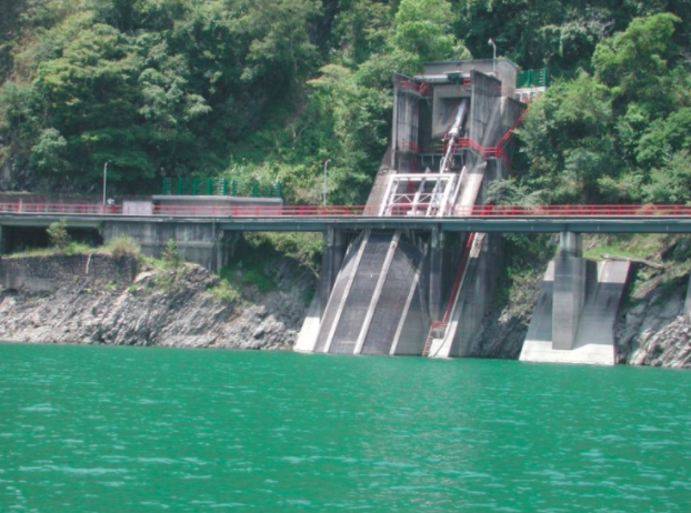
Operators, therefore, are towing side-scan sonar transducers at the optimum height above the bottom of the seafloor to produce better quality side scan sonographs. However, this can be done only if the bottom is moderately flat. Sonographs with maximum tonal intensity are easily produced on a steep slope, like valley banks, and any vertical situated structure. The strong signatures are then recorded over all ranges due to the poor geometry of sonographs produced without acoustic shadows. To create clear scanned images of a steep slope using side-scan sonar, rotating the towed fish or tilting the transducer face to the dipping slope surface is done. Cases conducted on the shore of the Wushieh Reservoir and Sun Moon Lake, in which the bank slopes can be varied from 10° to 60° are displayed. In general, the angle of the scanned slope determines the degree of the towed fish rotation angle. The rotation angle is set at a smaller angle than the slope, giving stronger returns from the lower slope. In contrast, the rotation angle set at a larger angle produces a null return outside the insonified area in the lower slope. To the offshore wind farm, a turbine foundation can be observed in the side-scan sonographs using this strategy. This demonstration also gives results that affirm the value of side-scan sonar as a powerful tool in underwater inspection.
Please note: This is a commercial profile

