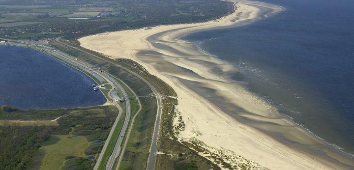
Efficient, open minded and international collaboration of research and engineering is vital to safeguard the densely populated and growing urban areas across the world which are facing the consequences of sea level rise and natural hazards…
In times of political uncertainty and economic turbulence, the global challenges of population growth and climate change are as relevant as ever before. The perspectives are clear. Even achieving the ambitious goal of last years’ COP21 in Paris, which was to keep the increase of global temperature well below 2°C, climate change will have a significant impact on our critical infrastructure. Causes and consequences of global warming are not further discussed here, but some particulars are important going forward. NASA1 and CSIRO2 report 25 centimetres of sea level rise in the past 135 years, and currently measure a rate of 3 to 4 millimetres per year. Furthermore, projections for the IPCC Assessment Report 4 suggest a plausible rise of sea level between 15 and 75 centimetres until the end of this century.
Should this be worrying us? Consider one of the aspects of sea level rise: the direct relationship between the average sea level and the risk of flooding for the low-lying areas in the world’s deltas. Moreover, extreme events of high water levels – like flooding or storm surges – play a key role in assessing flood safety. For example, for the existing Thames Barrier protecting the London area, the frequency of water levels able to breach the barrier could increase from initially about 1 in 1000 years, to a 1 in 20 risk by the end of this century3. The reliability and safety level of flood defences are more and more under pressure by these changing boundary conditions.
Population and assets are increasingly concentrated in these vulnerable regions and are demanding better protection and higher levels of safety. A recent study by the World Bank4 concludes that climate change alone will increase the number of people exposed to flooding by up to 15% by 2030 and 30% by 2080. Accounting for population growth, these numbers are expected to rise by another 15% and 45% respectively. As the rate of population growth has been higher in areas at risk of flooding, this is likely to be a conservative estimate5.
Can we stop or at least limit sea level rise? Can we reduce population growth or prevent people settling in floodplains? Needless to say, finding remedies for the causes and mitigation of risks is crucial, but depends entirely on time frame and costs, and, not at least, suffers from divergent interests. In parallel, deliberate engineering solutions for coastal protection are needed to meet the new requirements of an increased safety demand (growing population and economic activities in vulnerable areas) on one hand, and to deal with higher safety threats (sea level rise and natural hazards) on the other.
“We are developing software tools for engineers in order to model large deformations of soils in contact with water – for the design and assessment of coastal processes and structures.”
Flood defences form the interface between land and sea. As such, their design needs a deep understanding of multiple disciplines. Coasts consist of soils and rocks which are affected by the presence of water. In many places, soil in coastal areas is quite sandy, and flowing water can erode the soil and carry it away. The impact of waves on the shoreline, or on dykes, can cause erosion and damage structures, for example flood defences. To assess the stability and safety of coastal structures and flood defences, an understanding of both soil mechanics and fluid dynamics is therefore necessary.
Modelling soil and water, however, is conflicting in many existing numerical concepts. Soil is a natural material where the properties are heterogeneous and varied – from organic peats in the fens to sands and gravels at beaches and rivers. Soil remembers its past, so it is history-dependent, and its material behaviour is non-linear. Water can flow, it can be very dynamic, turbulent and can move across large distances. Concepts of both fields – soil and fluid mechanics – are adopted and combined in the material point method (MPM). Based on this unified numerical framework a computational software tool is being developed, aiming to model the interaction of soil, water and structures.
In the scope of the European research project MPM-DREDGE6 (grant agreement PIAP–GA–2012–324522) partners from academia and industry are developing physical concepts and implementing modelling approaches in a free and open software product. Several companies of the dredging and offshore sector are closely involved in the development to ensure the engineering applicability and to foster the highest possible impact on the market. They provide their expertise to validate the developed software by using measurements and monitoring data from their daily practice.
“We believe in openness and transparency, as is evident from the free availability of our software and models. It is our firm conviction that sharing knowledge and innovative insights worldwide enables living in deltas.” (Jaap Kwadijk, Science Director Deltares)
Five European universities (Cambridge, Hamburg, Padova, Barcelona and Delft), as well as the Dutch research institute Deltares, are joined together in a research initiative to further develop their ideas of advanced scientific methods which are implemented for engineering use in freely accessible and open source software. In January 2017, the first international conference on the modelling of large deformation and soil–water–structure interaction will be organised to share the developments.
The answer to global challenges should be an open and sincere cooperation of the scientific and engineering communities in Europe and beyond. This is in line with the appeal of European Commissioner Carlos Moedas7 who identified the benefits of open access and open science. Daring to share knowledge and developments in open source collaborations is a key issue to develop engineering solutions to ensure future living in deltaic regions.
1 http://climate.nasa.gov/vital-signs/sea-level
2 http://www.cmar.csiro.au/sealevel
3 https://www.gov.uk/government/publications/thames-estuary-2100-te2100
5 http://dx.doi.org/10.1016/j.gloenvcha.2012.07.004
6 http://cordis.europa.eu/project/rcn/105988_en.html
7 http://europa.eu/rapid/press-release_SPEECH-16-1225_en.htm
Alexander Rohe
Senior Researcher and Advisor
Deltares, Delft, The Netherlands
alex.rohe@deltares.nl
Please note: this is a commercial profile


