Climate Service Center Germany (GERICS) discusses here how innovative climate service products can help inform climate adaptation and mitigation, particularly within the agricultural sector
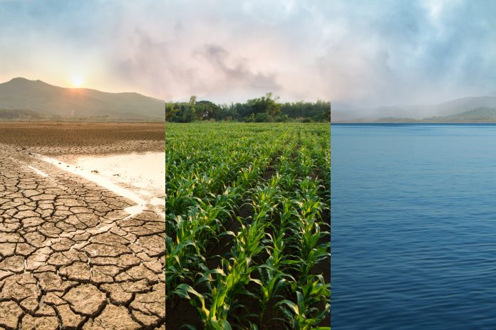
The IPCC Special Report on Climate Change and Land emphasised already in 2019 the need to change the ways food is produced and land is managed to cut emissions and keep warming below 1.5°C compared to preindustrial levels. At the same time, future climate change will increasingly affect food security through reduced yields, increased prices, reduced nutrient quality, and supply chain disruptions.
Climate change has already negatively affected the agriculture sector in Europe, and the number of climate extreme events negatively affecting agriculture in Europe is projected to increase. Sustainable land use and management approaches need to be informed by climate services to find optimal solutions under changing climate conditions.
Such climate services are based on climate model simulations projecting future climate evolutions. Based on large regional climate model ensemble simulations, the Climate Service Center Germany (GERICS) co-develops climate service products in collaboration with key practice partners. In the following, two recent example projects are presented, in which GERICS developed simulation-based products in new digital formats to inform climate adaptation and mitigation in the agricultural sector.
Climate information for adaptation in the agricultural sector – ADAPTER
Agriculture is among the economic sectors most vulnerable to weather extremes and climate change and is an important contributor to greenhouse gas emissions. In addition, actors ranging from local farmers to international companies are increasingly required to face their role in other ecological challenges, like biodiversity loss, soil erosion, and pollution from fertilisers, pesticides, and other chemicals.
Identifying optimal pathways to adapt to the multitude of challenges requires answers to questions such as:
- Which crops are suitable to help increase the diversity of crop rotations and increase resilience to pests, while fitting into a suitable climate niche where the risks of yield losses due to weather extremes are minimal?
- Where are the ideal sites to test such varieties, to select for weather events that are representative of a future climate?
- What practices of soil management or irrigation can compensate for soil moisture changes associated with climate change?
Available information on climate change is typically not specific enough to help us answer these questions. The knowledge transfer project ADAPTER was funded by the Helmholtz Association in 2019-2023 as a joint research project of the Institute for Bio- and Geosciences (IGB-3) of the Research Centre Jülich and the Climate Service Center Germany (GERICS).
The project generated such knowledge in close collaboration between climate scientists and agricultural advisors, farmers, plant breeding companies, educators, and the political administration, and thus help these actors adapt to climate change. The results are published in digital form of freely available and scientifically sound tools on the project’s online platform.
Supporting interactive tools
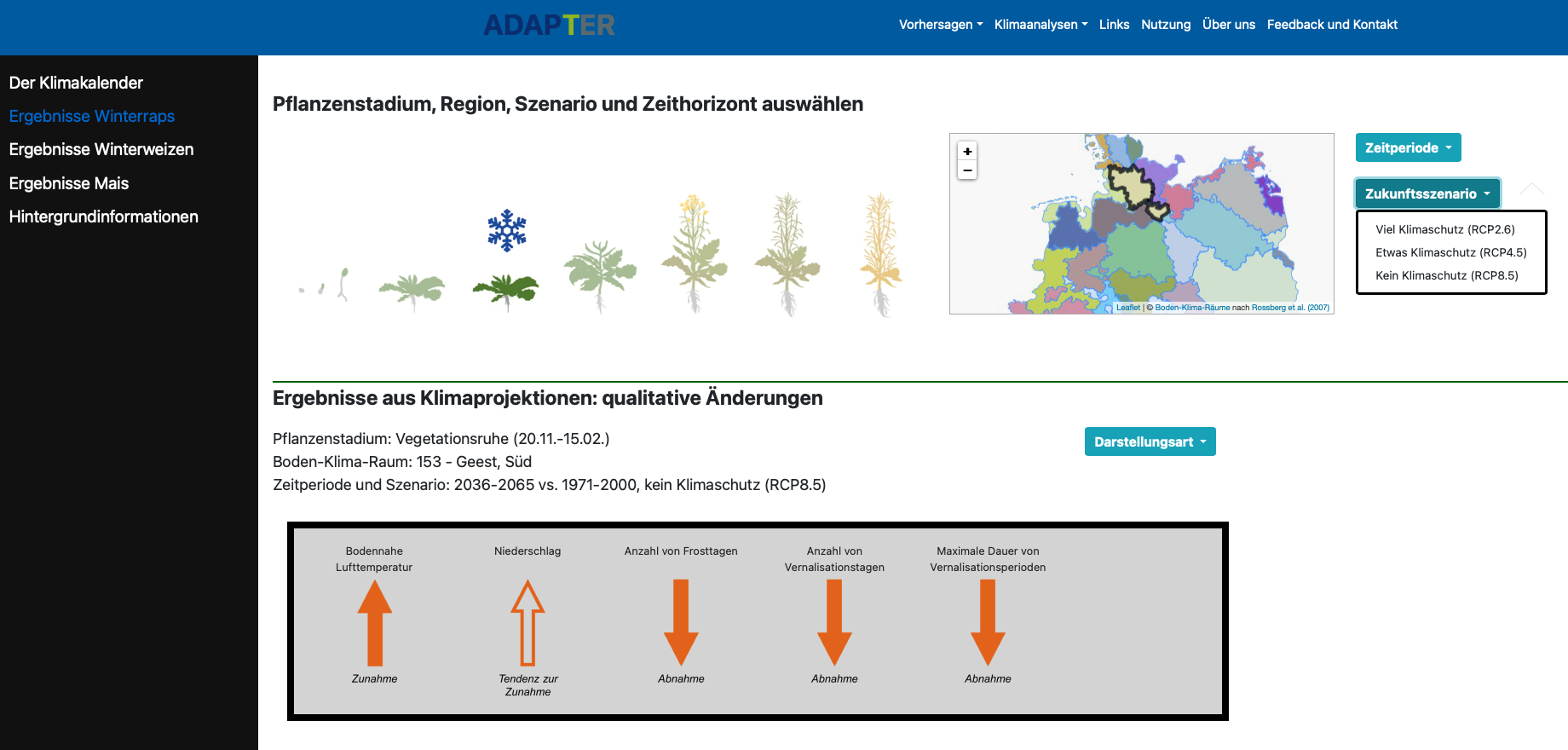
GERICS contributed to the platform with interactive tools to support the adaptation to climate change. These tools rely on the most recent and most comprehensive database of regional climate model projections for Europe from the EURO-CORDEX ensemble. At the time of writing, three interactive tools are publicly available: A Climate Map Browser featuring more than 30,000 maps for Europe and Germany, a Climate Calendar that provides information tailored to typical soil-climate zones and to specific development stages where crops are most vulnerable (Fig. 1), and a risk assessment of exceeding critical physiological thresholds.
A variety of positive responses from users shows us that the transdisciplinary approach implemented in ADAPTER can contribute to more sustainable and climate-resilient agriculture.
New digital format to transfer knowledge
Mitigation is becoming an increasingly important aspect to consider for the agricultural sector.
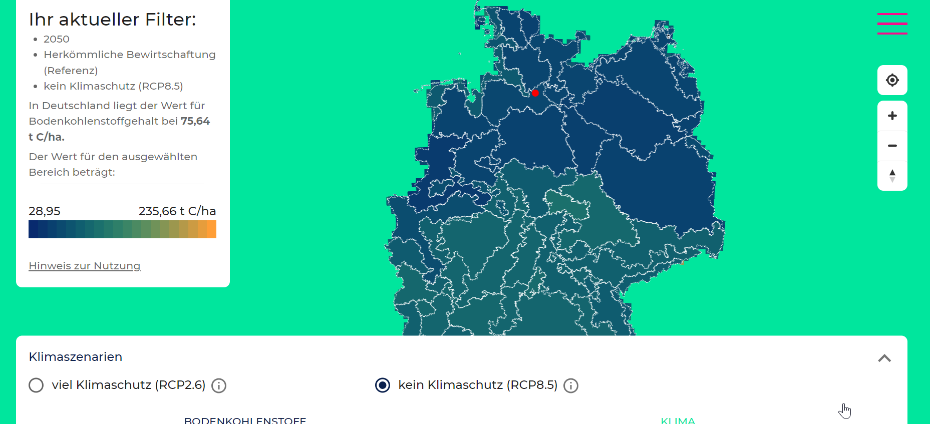
As a tool to implement mitigation requirements in the agricultural sector, GERICS has developed a Soil Carbon App that delivers land surface and climate data for Germany for future time periods. The app will focus on the effects of land management methods on carbon storage in agricultural soils.
This tool was developed together with partners from Research Centre Jülich as part of the “Net-Zero-2050” project, Cluster 1 of the “Helmholtz Climate Initiative” (HI-CAM), which was an interdisciplinary project aiming to support Germany on its way to achieving CO2 –neutrality before 2050, jointly by GERICS and several project partners.
The Soil Carbon App is unique in providing local information on the potential for carbon sequestration for different land management options under changing climatic conditions. This information is of interest to two main target groups: Decision makers in political and administrative entities and crop farmers willing to contribute to climate mitigation.
The users have the option to select from different agricultural methods, including, for instance, changes in crop rotations or the cultivation of cover crops. Such methods have the potential to increase the amount of organic material in the soil and thus support climate mitigation.
The methods’ carbon sequestration potentials and the applicability of those agricultural methods are tightly related to climate conditions; thus, they may need to be adapted to changing climatic conditions.
Providing a combination of climate and land surface model output
The app takes this into account, through the use of future climate projections.
While tools are available or being developed that either support farmers on the very local scale for today’s climate conditions or present climate change information on a coarser resolution, this web app provides a combination of climate model and land surface model output, covering Germany on a high resolution of 8 Km grid scale.
The model output is presented in the app graphically, concisely, and easily understood, with supporting texts and interpretation.
To this end, the development bundles the analyses of land surface and climate model data and technical innovation and combines them with an appealing user interface. The app was released in 2022.

This work is licensed under Creative Commons Attribution-NonCommercial-NoDerivatives 4.0 International.

