Why does Mount Everest keep growing? Researchers from University College London (UCL) have revealed the forces behind the continued growth of Earth’s tallest peak
The study reveals that Mount Everest is not only the product of geological processes but is actively growing taller each year.
The continued growth of Everest
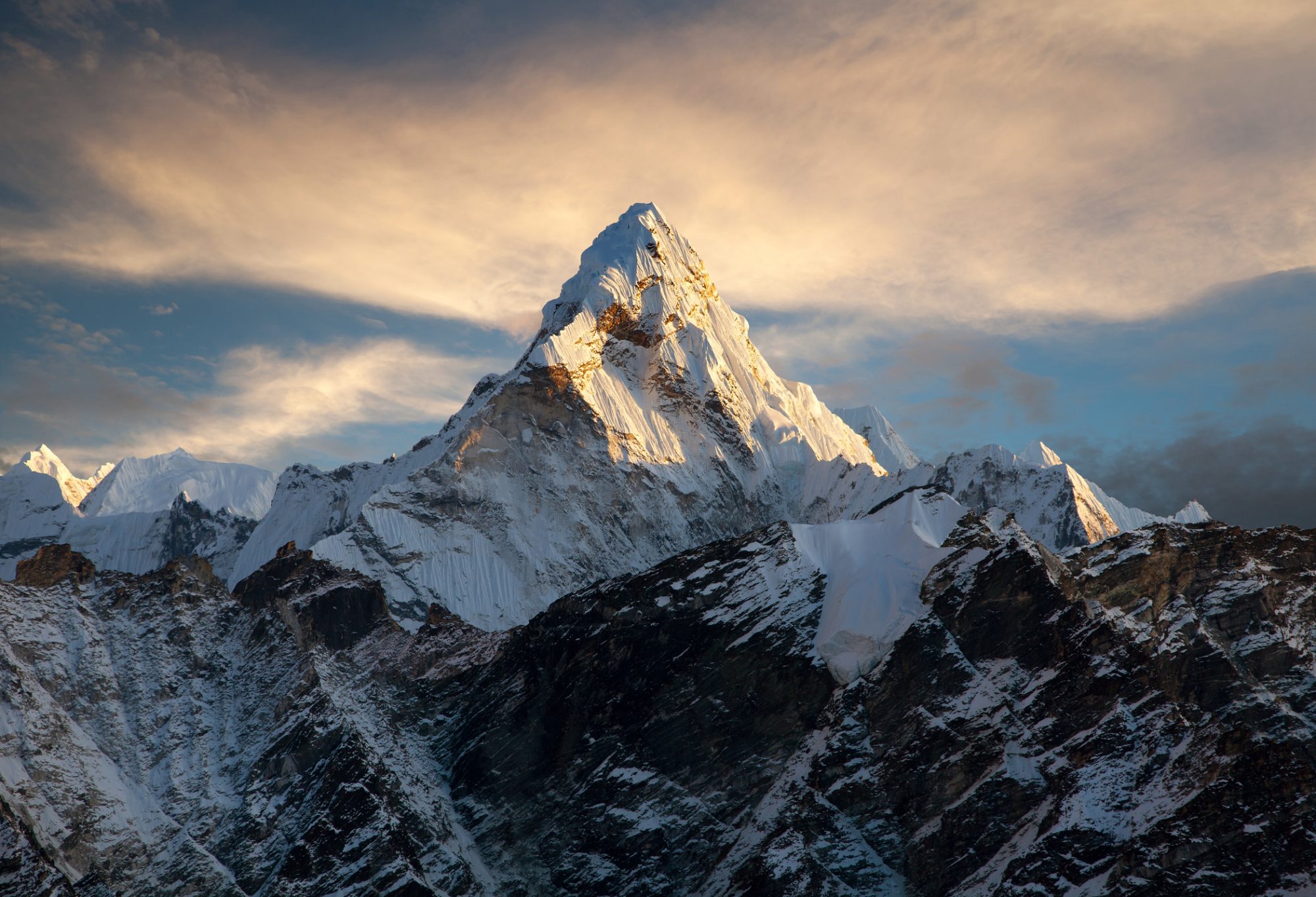
Mount Everest stands is 8,849 meters, towering over its neighbouring peaks in the Himalayas. What makes Everest’s height particularly remarkable is its ongoing growth, put down to a phenomenon known as isostatic rebound.
This process occurs when the Earth’s crust adjusts after the weight removal, in this case, caused by the erosion of a nearby river gorge.
The research, led by Dr. Xu Han from China University of Geosciences, points to the Arun river system as a key player in this geological drama. Over millennia, the Arun river, running east of Everest, has carved a deep gorge, washing away massive amounts of sediment and rock. This erosion has significantly lightened the load on the Earth’s crust beneath Everest, allowing it to rebound or spring upwards.
According to PhD student Adam Smith, a co-author of the study, this uplift is not limited to just Everest but also affects neighbouring peaks like Lhotse and Makalu. “Mount Everest is a remarkable mountain of myth and legend, and it’s still growing. Our research shows that as the nearby river system cuts deeper, the loss of material is causing the mountain to spring further upwards.”
The rebound effect
Dr. Matthew Fox, another co-author, emphasises that while erosion constantly wears down these mountains, the rebound effect from isostasy exceeds the erosive forces. Using GPS instruments, scientists have observed Everest growing by approximately 2 millimetres annually, a subtle yet significant change over geological timeframes.
The study shows the relationship between erosion and uplift in shaping Earth’s landscapes. By analysing the erosion rates of rivers like the Arun and Kosi, researchers pinpointed a critical juncture around 89,000 years ago when the Arun River merged with the Kosi River network. This event, known as drainage piracy, intensified the erosive power of the Kosi River, accelerating the uplift of Everest and its neighboring peaks.
“The changing height of Mount Everest really highlights the dynamic nature of the Earth’s surface,” remarks Dr. Xu Han. The interaction between the erosive power of rivers and the upward pressure of the Earth’s mantle creates a feedback loop, continuously pushing Everest higher than it would otherwise be.
As Dr Jin-Gen Dai notes, the unique topography shaped by the Arun River’s path provides further insight into Everest’s extreme height. The river’s journey from high altitudes to a sudden drop in elevation southwards creates conditions conducive to significant geological activity, further influencing the region’s landscape.
Mount Everest’s stature in the Himalayas is not just a result of passive geological forces but an ongoing interplay of erosion and uplift.


